What Is Wetlands & WOTUS?
A wetland delineation identifies and maps areas that meet the federal wetland criteria (typically based on hydrophytic vegetation, hydric soils, and wetland hydrology) and separates them from uplands.
WOTUS is a legal/regulatory term defining which waters and wetlands are subject to federal jurisdiction under the Clean Water Act—and therefore may require permits/authorizations for discharges of dredged or fill material (e.g., grading, pad fill, road crossings, utility trenches).
Why “WOTUS” has been shifting
- The Supreme Court’s Sackett v. EPA (2023) decision significantly narrowed CWA jurisdiction for wetlands, emphasizing a continuous surface connection concept rather than broader “significant nexus” approaches.
- EPA and the Army have continued to revise/clarify the WOTUS definition via rulemaking, including a proposed updated definition announced in November 2025.
Request Your Wetlands & WOTUS Services Today
Texas’ most trusted environmental experts – comprehensive by design.
When Is It Required?
You typically need a wetlands or Waters of the U.S. (WOTUS) evaluation when buying or financing commercial real estate where on-site waters could affect buildable area, entitlements, environmental due diligence, or lender risk management. These evaluations are also important when planning site grading, fill placement, detention or retention facilities, or new impervious cover near drainage features. Linear and infrastructure projects, including roads, pipelines, transmission lines, fiber routes, and utility crossings, may require wetlands or WOTUS review when they cross channels, wetlands, or floodplain-adjacent lowlands. Developers may also need documentation when pursuing permits and agencies request confirmation of wetland or WOTUS constraints. In addition, an evaluation may be necessary when responding to a potential federal permitting trigger, such as U.S. Army Corps of Engineers Section 404, an enforcement concern, or a jurisdictional dispute.
ESE Partners’ Approach
ESE is Comprehensive by Design, which means we treat wetlands and Waters of the U.S. (WOTUS) as a project delivery risk, not just a biology exercise. Our team provides fast field mobilization to support acquisition and design schedules, along with practical, defensible mapping aligned with current federal interpretations following the Sackett decision. We help identify constraints early, including avoidance and minimization opportunities, to reduce mitigation needs and costly redesign. ESE also supports permitting strategy through Section 404/401 pathway screening, data package preparation, and agency coordination. With Texas execution experience across commercial real estate, energy, and infrastructure projects, we support everything from urban infill sites to greenfield developments.
Our Process
- Desktop screening: NWI/NHD, soils, topo, aerials, floodplain, prior reports; identify likely wetlands/streams and data gaps.
- Field delineation: Data points, boundaries, photo logs, and mapping-grade GPS collection.
- Waters/WOTUS screening: Evaluate aquatic resources and connectivity context consistent with current federal framework post-Sackett.
- Impact planning support: Avoid/minimize options; conceptual crossing/footprint review with designers.
- Documentation package: Delineation report, figures, shapefiles/CAD-friendly deliverables.
- Agency coordination (as needed): Support USACE coordination and permitting documentation (404/401).
Regulatory Framework (What Governs This Work)
Key federal drivers for wetlands and Waters of the U.S. (WOTUS) evaluations include Clean Water Act jurisdiction and the evolving definition and implementation of WOTUS following Sackett v. EPA (2023). Projects may also require consideration of U.S. Army Corps of Engineers (USACE) Section 404 permitting for dredged or fill discharges, along with related Section 401 water quality certification requirements. In addition, ongoing EPA and Army rulemaking activity, including the announced proposed rule in November 2025 and related Federal Register publication, may affect how jurisdictional features are evaluated and permitted. In Texas, wetland and stream constraints can also intersect with local floodplain rules and drainage criteria, so ESE coordinates these considerations early to help prevent late-stage design surprises.
Risks of Not Completing This Service
Skipping wetlands/WOTUS work early can lead to:
- Late-stage redesign (loss of yield/buildable area; shifting detention, access, and utility routing).
- Permitting delays if 404/401 becomes necessary after plans are set.
- Cost escalation from avoidable impacts, mitigation needs, or contractor downtime.
- Transaction uncertainty when lenders/investors discover aquatic constraints late in diligence.
More Natural Resources Services

Protected Species and Wildlife
ESE Partners provides a wide range of protected species and other wildlife-related services to our clients. ESE’s seasoned Biologists are permitted to conduct presence/absence surveys for federally endangered species and habitat assessments. We have conducted acoustic monitoring and analysis in multiple states for a wide variety of bat and herpetological species. We provide natural resource assessments and federal and state regulatory consultation services as required by our clients’ projects.

Regulatory and Planning Documentation
ESE is experienced with a variety of reporting and field investigations required under the National Environmental Policy Act (NEPA) including Environmental Assessments and Categorical Exclusions and other similar studies requested by our clients. ESE conducts Critical Issues Analyses and Site Characterization Studies for a variety of clients, but primarily for proposed renewable energy development. ESE is experienced with studies required by municipalities, including but not limited to, Environmental Resource Inventories required by the City of Austin.
Industries We Serve
ESE operates in a wide range of industries, all with unique needs and regulatory obligations. We offer experts who understand the broad complexity of environmental challenges faced by today’s businesses.

Real Estate Brokers & Developers
ESE helps brokers and developers reduce deal friction and avoid surprises through fast, defensible environmental due diligence. We support property evaluations, redevelopment risk screening, and transaction-ready reporting for Texas assets.

Private Equity/Capital Investors
Transaction support for acquisitions and portfolio oversight, including Phase I/II ESAs and risk-based evaluation. We provide clear findings, practical recommendations, and scalable diligence support.

Financial Institutions
ESE supports lender-driven environmental due diligence and portfolio risk management, including Phase I/II ESAs and risk screening. We deliver consistent, defensible reporting aligned with credit and closing timelines.

Attorneys
Technical support for environmental risk, liability evaluation, and regulatory strategy. We provide clear documentation and expert collaboration to support transactions, compliance matters, and remediation planning.
Why ESE Partners
As Texas’ Most Trusted Environmental Experts — Comprehensive by Design, ESE combines technical defensibility with deal-speed execution for wetlands and Waters of the U.S. (WOTUS) projects. Clients choose ESE for our Texas-focused teams, who understand how development actually gets built across Houston, Dallas–Fort Worth, Austin, and San Antonio. Our integrated services extend beyond wetlands to include environmental due diligence, remediation, compliance, natural and cultural resources, and building sciences, giving clients one firm and one coordinated schedule. We also provide clear communication that translates wetlands and WOTUS findings into practical design actions, such as avoidance, minimization, or permitting, to help protect schedule and budget. With scalable statewide delivery, ESE can support individual sites, portfolios, and linear projects across Texas.
Need a wetlands/WOTUS delineation in Texas?
ESE Partners can mobilize quickly and deliver permitting-ready documentation. Request a proposal—keep your deal and design schedule moving.
Our Natural Resource Projects
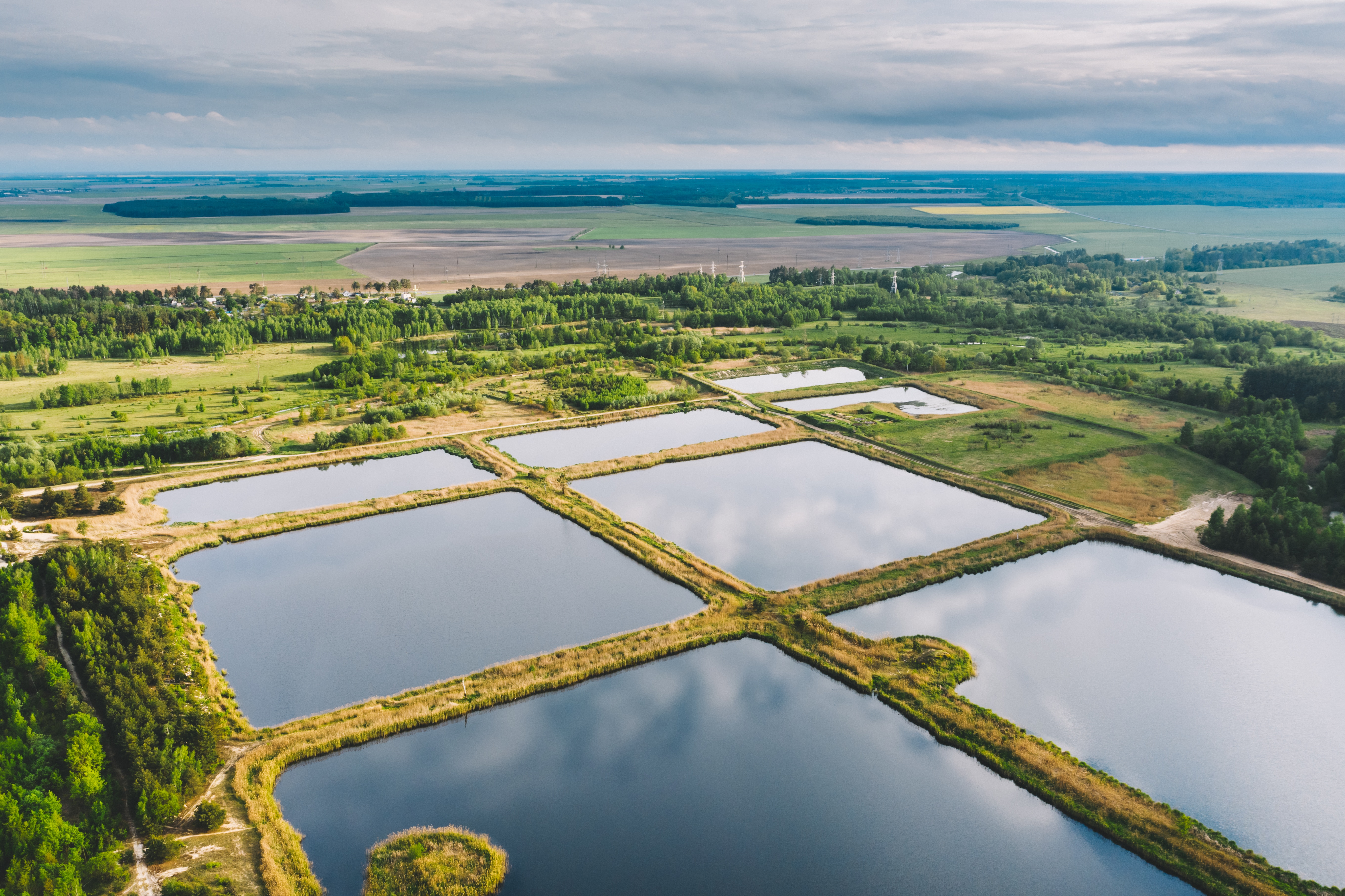
WOTUS Delineation for Proposed Stormwater Detention Improvements
ESE conducted a comprehensive Water Resources Evaluation for an approximately 102-acre tract to support planned stormwater detention improvements and assess potential impacts to Waters of the United States under Section 404 of the Clean Water Act.
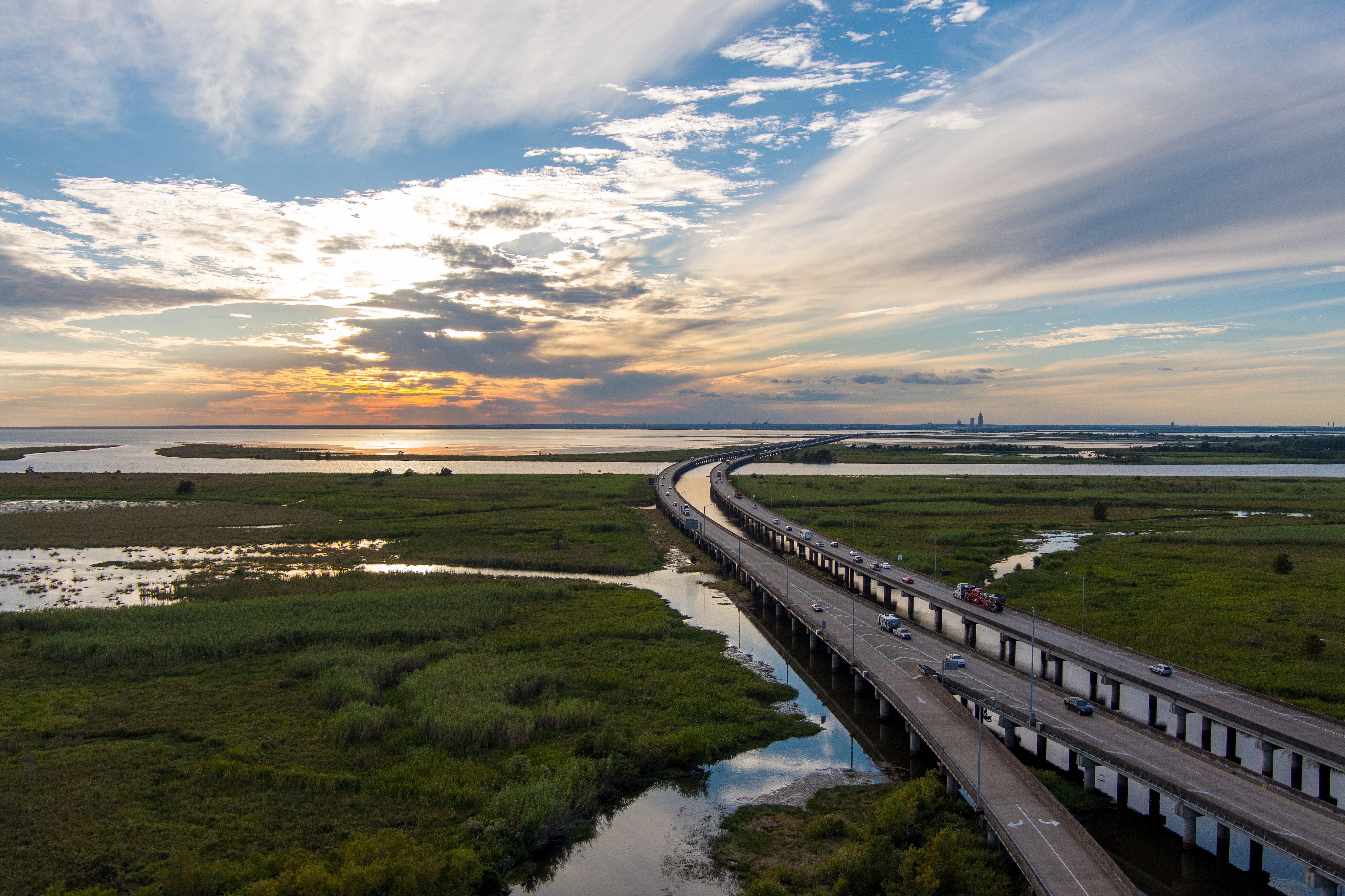
Comprehensive Water Resources Evaluation for Linear Transportation Corridor
ESE conducted a comprehensive Wetland and Waters of the United States evaluation along an approximately 16-mile coastal transportation corridor in South Texas to support ongoing infrastructure planning and regulatory coordination.
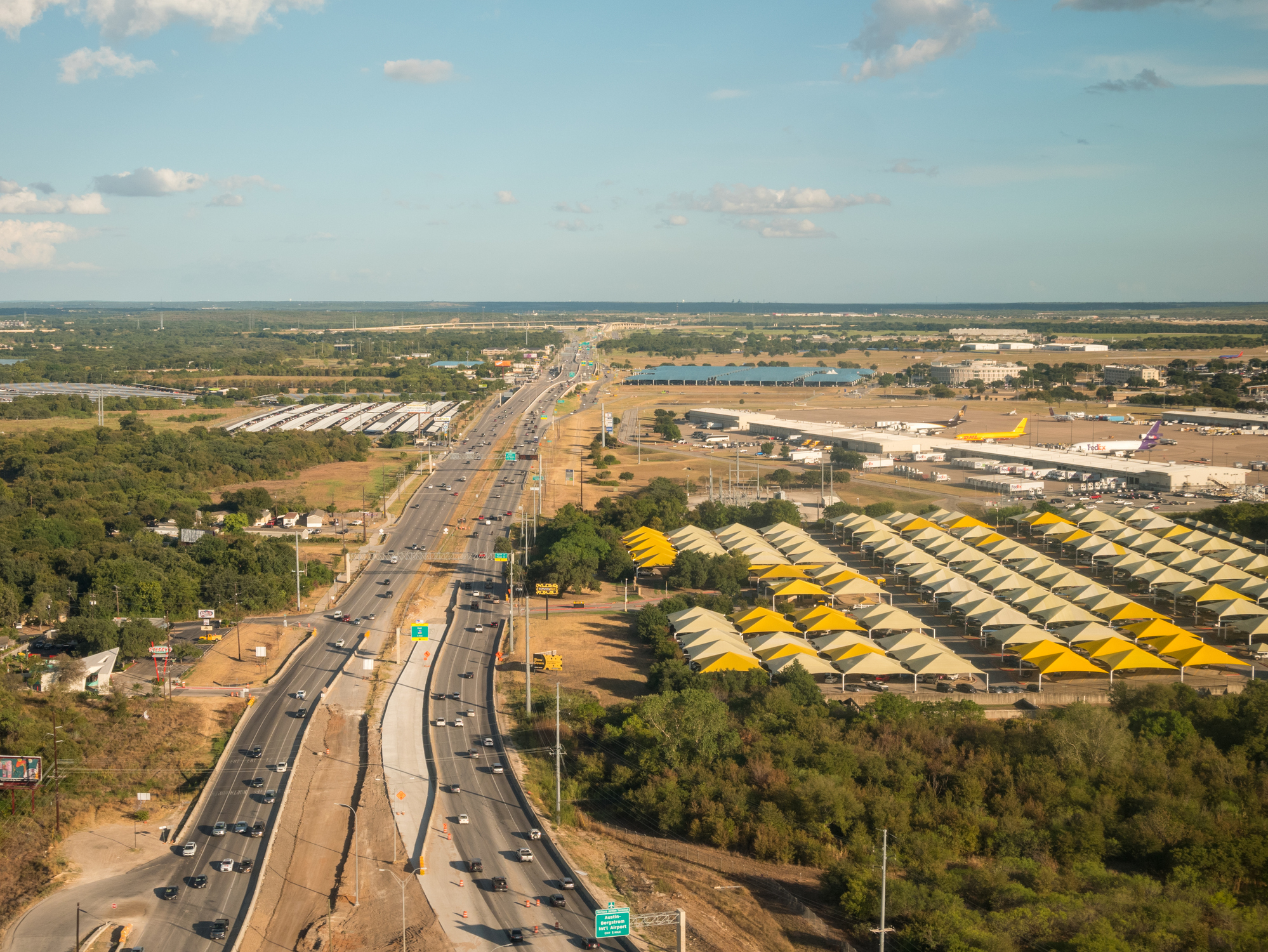
City of Austin ERI
ESE prepared a City of Austin Environmental Resources Inventory (ERI) to fulfill City of Austin requirements and support the project’s planning and development for regional airport parking.
Frequently Asked Questions About Wetlands & WOTUS Services
What is a wetland delineation and what does WOTUS mean for my project?
A wetland delineation identifies and maps areas that meet the federal wetland criteria (typically based on hydrophytic vegetation, hydric soils, and wetland hydrology) and separates them from uplands. WOTUS is a legal and regulatory term defining which waters and wetlands are subject to federal jurisdiction under the Clean Water Act — and therefore may require permits and authorizations for discharges of dredged or fill material (e.g., grading, pad fill, road crossings, utility trenches). Wetlands and WOTUS are deal-critical because they drive whether federal Clean Water Act (CWA) permitting is triggered, especially USACE Section 404 dredge/fill permits and related Section 401 water quality certification.
Has the WOTUS definition recently changed, and how does that affect my Texas project?
Yes — the WOTUS definition has been in significant flux. The Supreme Court’s Sackett v. EPA (2023) decision significantly narrowed CWA jurisdiction for wetlands, emphasizing a continuous surface connection concept rather than broader “significant nexus” approaches. EPA and the Army have continued to revise and clarify the WOTUS definition via rulemaking, including a proposed updated definition announced in November 2025 — creating real timing and scope risk for acquisitions and development schedules. ESE Partners provides practical, defensible mapping aligned with current federal interpretations post-Sackett, so your project isn’t caught off guard by shifting regulatory interpretations.
When does my Texas development or acquisition project need a wetlands/WOTUS evaluation?
You typically need a wetlands/WOTUS evaluation when you’re buying or financing commercial real estate where on-site waters could affect buildable area or entitlements, planning site grading, fill, detention/retention, or new impervious cover near drainage features, designing road, pipeline, transmission, fiber, or utility crossings over channels, wetlands, or floodplain-adjacent lowlands, pursuing development permits where agencies request wetlands/WOTUS documentation to confirm constraints, or responding to a potential federal permitting trigger (e.g., USACE Section 404), enforcement concern, or jurisdictional dispute. If your site has low areas, drainage features, ponds, creeks, or floodplain fringes, wetlands and WOTUS can become the fastest way to derail a closing or construction start — often late in design, when changes are expensive.
What are the risks of skipping a wetlands/WOTUS evaluation early in a project?
Skipping wetlands and WOTUS work early can lead to late-stage redesign (loss of yield/buildable area; shifting detention, access, and utility routing), permitting delays if 404/401 becomes necessary after plans are set, cost escalation from avoidable impacts, mitigation needs, or contractor downtime, and transaction uncertainty when lenders and investors discover aquatic constraints late in diligence. ESE Partners addresses this risk by identifying constraints early and translating wetlands/WOTUS findings into clear design actions (avoid, minimize, permit) that protect schedule and budget — and by coordinating wetland and stream constraints with local floodplain rules and drainage criteria so designs don’t get surprised late.