PROJECT OVERVIEW
ESE conducted a comprehensive Water Resources Evaluation for an approximately 102-acre tract to support planned stormwater detention improvements and assess potential impacts to Waters of the United States under Section 404 of the Clean Water Act. The evaluation included desktop review, floodplain analysis, field delineation, and jurisdictional assessment to provide regulatory clarity prior to design advancement and potential permitting.
CHALLENGES
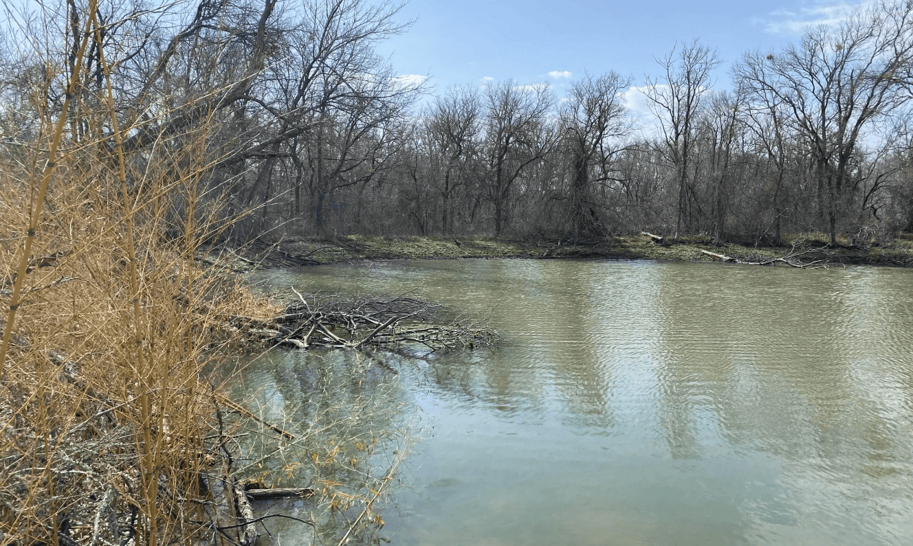
The property is located within the Northern Humid Gulf Coastal Prairies and includes modified prairie, agricultural land, drainage infrastructure, and previously constructed detention features. Historic aerial imagery documented decades of channel excavation, basin expansion, and surrounding development, creating a complex hydrologic setting influenced by anthropogenic alteration. FEMA mapping indicated that portions of the tract lie within the 100-year floodplain and regulatory floodway, while soils data identified hydric components across roughly half of the site. Multiple mapped wetlands and drainage features required field verification to determine whether they represented jurisdictional waters or upland excavations. Establishing defensible boundaries and regulatory status was essential to maintaining project schedule certainty for a large-scale flood control initiative.
ESE’S APPROACH
ESE performed a detailed map and database review including USGS topographic mapping, National Wetlands Inventory data, NRCS soil survey information, FEMA floodplain mapping, LiDAR terrain modeling, and long-term precipitation analysis. Field delineation was conducted in accordance with the 1987 USACE Wetland Delineation Manual and the Atlantic and Gulf Coastal Plain Regional Supplement using the three-parameter methodology of hydrology, vegetation, and soils. Geospatial data were collected with sub-meter accuracy consistent with USACE Galveston District standards. Hydrologic indicators were evaluated in the context of both antecedent precipitation conditions and regional drought indices to ensure accurate interpretation of field conditions.
KEY FINDINGS
- Four emergent wetland features were identified, totaling approximately 2.48 acres
- Two intermittent stream features were documented, totaling approximately 3,268 linear feet
- One stormwater basin and one stock pond were identified within the tract
- All identified features are likely non-jurisdictional due to excavation in uplands, lack of downstream connectivity, or development within man-made drainage infrastructure
PROJECT IMPACT
Through a rigorous delineation process and careful evaluation of hydrologic connectivity, ESE distinguished mapped and constructed features from jurisdictional waters, eliminating unnecessary permitting exposure. By providing a clear and defensible regulatory pathway, the team reduced uncertainty early in project planning and supported efficient advancement of critical flood mitigation infrastructure. This project reflects ESE’s Texas First approach by combining technical precision, regulatory expertise, and practical judgment to keep complex public infrastructure projects moving forward with confidence.