What Are Aerial Drone Services?
Aerial drone services use small unmanned aircraft systems—commonly referred to as drones or UAS—to collect aerial imagery, video, and site documentation from vantage points that are difficult, time-consuming, or unsafe to access from the ground. For environmental and infrastructure projects, drone data can support site reconnaissance, construction progress tracking, stormwater inspections, pipeline and utility corridor observations, stockpile documentation, land development planning, and pre-/post-event assessments.
Commercial drone operations in the United States are regulated under 14 CFR Part 107, which applies to the registration, airman certification, and operation of civil small unmanned aircraft systems. The FAA also requires drone pilots operating under the Small UAS Rule to obtain a Remote Pilot Certificate.
Request Your Aerial Drone Services Today
Texas’ most trusted environmental experts – comprehensive by design.
When Are Aerial Drone Services Needed?
ESE’s aerial drone services are valuable when project teams need fast, defensible, and visually clear site information for:
- Commercial real estate due diligence prior to acquisition, refinancing, or redevelopment
- Phase I ESA and environmental site assessment support, including visual site context and adjoining property observations
- Large-acreage land development where ground access is limited or time-intensive
- Construction progress documentation for lenders, owners, developers, and contractors
- Stormwater and erosion control observations on active construction or industrial sites
- Pipeline, utility, and linear corridor reconnaissance
- Industrial facility documentation for compliance, maintenance planning, or incident response
- Pre- and post-storm assessments following flooding, wind events, or other disruptions
- Stockpile, laydown yard, and material area documentation
- Access-constrained sites where terrain, vegetation, water, safety concerns, or operational activity limit ground visibility
ESE Partners’ Approach
ESE’s drone work is not just photography; it is environmental and site intelligence collected by consultants who understand risk, compliance, and project execution. Our approach is built around speed, with quick mobilization and usable imagery or documentation that helps keep transactions, development schedules, and compliance deadlines moving. We coordinate flight objectives, access limitations, site constraints, and deliverables before mobilization so the final product supports the decision at hand. ESE provides practical recommendations without overstating findings, integrating drone imagery with field observations, regulatory context, and professional judgment. With Texas expertise across urban, industrial, energy, coastal, rural, and infrastructure sites, our teams understand real-world site conditions and project constraints. We also prioritize safety and compliance by considering FAA operating requirements, site-specific hazards, controlled airspace, and client operational protocols before flight activities begin.
Our Process
- Project Scoping: We confirm the project objective, site location, schedule, deliverable needs, and any known access or operational constraints.
- Airspace and Site Review: ESE evaluates the location for flight feasibility, potential controlled airspace issues, weather, site hazards, and operational restrictions.
- Flight Planning: We define flight paths, target areas, image types, altitude considerations, and documentation priorities.
- Field Mobilization: Our team conducts drone operations with attention to safety, visual line-of-sight, surrounding land uses, and active site conditions.
- Data Review and Organization: Imagery, video, and field notes are reviewed for clarity, coverage, and relevance to the project objective.
- Deliverables: Depending on the scope, ESE can provide annotated photo logs, aerial imagery, video files, inspection summaries, map exhibits, or supporting documentation for environmental, construction, or compliance reports.
Regulatory Framework
Aerial drone services must be performed with awareness of federal aviation requirements and project-specific site controls. Commercial drone operations in the United States are governed by FAA Part 107, which establishes requirements for small unmanned aircraft systems, including the need for operators to hold a Remote Pilot Certificate. Certain operations that deviate from standard Part 107 rules may require FAA waiver approval, which allows drone pilots to use alternative operating methods when they can demonstrate safety. In addition to FAA requirements, site-specific restrictions may apply at industrial facilities, airports, ports, military areas, utility corridors, active construction sites, and private properties, where access, safety, security, or operational protocols can affect flight planning. While drone imagery does not replace required environmental inspections, sampling, or regulatory reporting, it can provide valuable supporting documentation for environmental due diligence, stormwater compliance, site reconnaissance, and project records.
Risks of Not Using Aerial Drone Services
Skipping drone-based site documentation can leave project teams with incomplete visibility—especially on large, active, or difficult-to-access properties. Common risks include:
- Missed site conditions that are not visible from public roads or limited ground access points
- Deal delays caused by incomplete property documentation or follow-up questions from lenders, investors, or attorneys
- Higher field costs when large sites require repeated or inefficient ground reconnaissance
- Construction documentation gaps that complicate draw requests, progress reviews, or dispute resolution
- Compliance exposure when site conditions, drainage patterns, disturbed areas, or access constraints are not adequately documented
- Safety concerns from sending personnel into areas that could be observed more efficiently from the air
More Environmental Due Diligence Services

Phase I Environmental Site Assessment (ESAs)
ESE provides lender approved ASTM-E1527 and similar Phase I Environmental Site Assessments and related transaction screens which are often required when a property is externally financed. The purpose of a Phase I ESA is to identify Recognized Environmental Conditions (RECs) associated with a parcel of commercial real estate with respect to the range of contamination within the scope of CERCLA and petroleum products.

Phase II Environmental Site Assessment (ESAs)
A Phase II Environmental Site Assessment is often warranted when a Phase I ESA identifies a Recognized Environmental Condition, requiring further investigation. The purpose of a Phase II ESA is to confirm or deny the presence of chemicals of concern in the environment. The Phase II ESA involves the sampling and laboratory analysis of multiple medias, often including soil, soil gas, and groundwater. The analytical testing results are compared to regulatory limits and criteria established by the applicable government agency. Further remedial action may be warranted based on the results of the Phase II ESA.
Industries We Serve
ESE operates in a wide range of industries, all with unique needs and regulatory obligations. We offer experts who understand the broad complexity of environmental challenges faced by today’s businesses.

Real Estate Brokers & Developers
ESE helps brokers and developers reduce deal friction and avoid surprises through fast, defensible environmental due diligence. We support property evaluations, redevelopment risk screening, and transaction-ready reporting for Texas assets.

Private Equity/Capital Investors
Transaction support for acquisitions and portfolio oversight, including Phase I/II ESAs and risk-based evaluation. We provide clear findings, practical recommendations, and scalable diligence support.

Financial Institutions
ESE supports lender-driven environmental due diligence and portfolio risk management, including Phase I/II ESAs and risk screening. We deliver consistent, defensible reporting aligned with credit and closing timelines.

Attorneys
Technical support for environmental risk, liability evaluation, and regulatory strategy. We provide clear documentation and expert collaboration to support transactions, compliance matters, and remediation planning.
Why ESE Partners
ESE Partners is Texas’ Most Trusted Environmental Experts — Comprehensive by Design, and our aerial drone services are supported by a broader environmental consulting platform, giving clients more than images: they get context. Clients choose ESE for Texas-focused service across Houston, Dallas-Fort Worth, Austin, San Antonio, and statewide markets, backed by environmental due diligence expertise for acquisitions, refinancing, development, and lender-driven requirements. Our integrated consulting capabilities span due diligence, remediation, compliance, natural and cultural resources, and building sciences, allowing drone data to be interpreted alongside broader site and regulatory conditions. With responsive project teams that understand transaction urgency and construction timelines, ESE can scale support for single-site projects, portfolio work, industrial assets, energy corridors, and infrastructure programs. We deliver clear, practical outputs that help clients make decisions, not just collect data.
Need aerial documentation for a property, facility, corridor, or active construction site?
Talk to ESE Partners today to schedule aerial drone services in Texas and get the site intelligence you need to move forward with confidence.
Our Environmental Due Diligence Projects
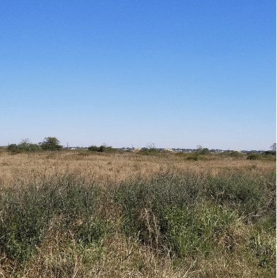
Phase I and II for residential Home Developer in Flushear, Texas
ESE performed a Phase I ESA on approximately 143-acre property in a future master-planned community in the greater Houston area.

Pre-Acquisition Due Diligence in Downtown San Antonio
ESE performed pre-acquisition due diligence for two contiguous city blocks in downtown San Antonio, Texas with development history dating back to the late 1800’s.
Phase I and II for residential Home Developer in Flushear, Texas
ESE performed a Phase I ESA on approximately 143-acre property in a future master-planned community in the greater Houston area.
Frequently Asked Questions About Aerial Drone Services
What are aerial drone services, and what can drone data support?
Aerial drone services use small unmanned aircraft systems — commonly referred to as drones or UAS — to collect aerial imagery, video, and site documentation from vantage points that are difficult, time-consuming, or unsafe to access from the ground. For environmental and infrastructure projects, drone data can support site reconnaissance, construction progress tracking, stormwater inspections, pipeline and utility corridor observations, stockpile documentation, land development planning, and pre-/post-event assessments. Commercial drone operations in the United States are regulated under 14 CFR Part 107, which applies to the registration, airman certification, and operation of civil small unmanned aircraft systems, and the FAA requires drone pilots operating under the Small UAS Rule to obtain a Remote Pilot Certificate.
When are aerial drone services useful?
ESE’s aerial drone services are valuable when project teams need fast, defensible, and visually clear site information for commercial real estate due diligence prior to acquisition, refinancing, or redevelopment, Phase I ESA and environmental site assessment support (including visual site context and adjoining property observations), large-acreage land development where ground access is limited or time-intensive, construction progress documentation for lenders, owners, developers, and contractors, stormwater and erosion control observations on active construction or industrial sites, pipeline, utility, and linear corridor reconnaissance, industrial facility documentation for compliance, maintenance planning, or incident response, pre- and post-storm assessments following flooding, wind events, or other disruptions, stockpile, laydown yard, and material area documentation, and access-constrained sites where terrain, vegetation, water, safety concerns, or operational activity limit ground visibility.
What are the risks of not using aerial drone services?
Skipping drone-based site documentation can leave project teams with incomplete visibility — especially on large, active, or difficult-to-access properties. Common risks include missed site conditions that are not visible from public roads or limited ground access points, deal delays caused by incomplete property documentation or follow-up questions from lenders, investors, or attorneys, higher field costs when large sites require repeated or inefficient ground reconnaissance, construction documentation gaps that complicate draw requests, progress reviews, or dispute resolution, compliance exposure when site conditions, drainage patterns, disturbed areas, or access constraints are not adequately documented, and safety concerns from sending personnel into areas that could be observed more efficiently from the air.
What does ESE Partners' aerial drone services process look like, and how is it regulated?
ESE’s drone work is not just photography — it is environmental and site intelligence collected by consultants who understand risk, compliance, and project execution, delivering practical recommendations without overstating findings and integrating drone imagery with field observations, regulatory context, and professional judgment. The process includes: project scoping (confirming objective, site location, schedule, deliverable needs, and known constraints); airspace and site review (evaluating flight feasibility, potential controlled airspace issues, weather, site hazards, and operational restrictions); flight planning (defining flight paths, target areas, image types, altitude considerations, and documentation priorities); field mobilization (conducting operations with attention to safety, visual line-of-sight, surrounding land uses, and active site conditions); data review and organization (reviewing imagery, video, and field notes for clarity, coverage, and relevance); and deliverables (annotated photo logs, aerial imagery, video files, inspection summaries, map exhibits, or supporting documentation). Commercial drone operations are governed by FAA Part 107 (including the requirement for operators to hold a Remote Pilot Certificate), and certain operations that deviate from standard Part 107 rules may require FAA waiver approval. Site-specific restrictions may also apply at industrial facilities, airports, ports, military areas, utility corridors, active construction sites, and private properties. While drone imagery does not replace required environmental inspections, sampling, or regulatory reporting, it can provide valuable supporting documentation for environmental due diligence, stormwater compliance, site reconnaissance, and project records.